Make Your Own Map (Sandbox)

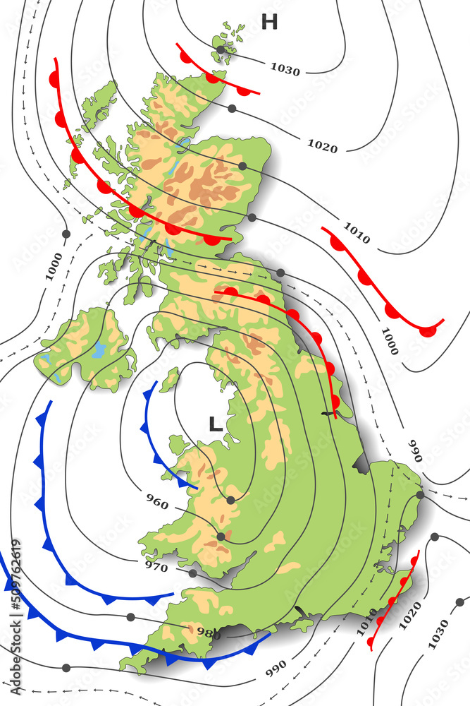
Contour lines join points of equal height. This is very useful on maps because it makes it easy to see how hilly a place is. On a map, a hill will look like concentric circles or, more likely, concentric wobbly loops. If you walked around the loop, you will always be at the same height.
The large outer loops represent the bottom of the hill, while the small inner loops represent the top of the hill. You can see how steep a hill is by how close the contour lines are. When the lines are close together, the hill is very steep. When the lines are far apart, the hill is not steep. You can work out the gradient of the hill by counting how many contour lines you cross on the way up. Contour lines don’t just have to mark points of equal height. For example, weather maps use contour lines to mark points of equal pressure.